WEATHER BLOG: Boom or bust storms to impact Thursday along with excessive heat
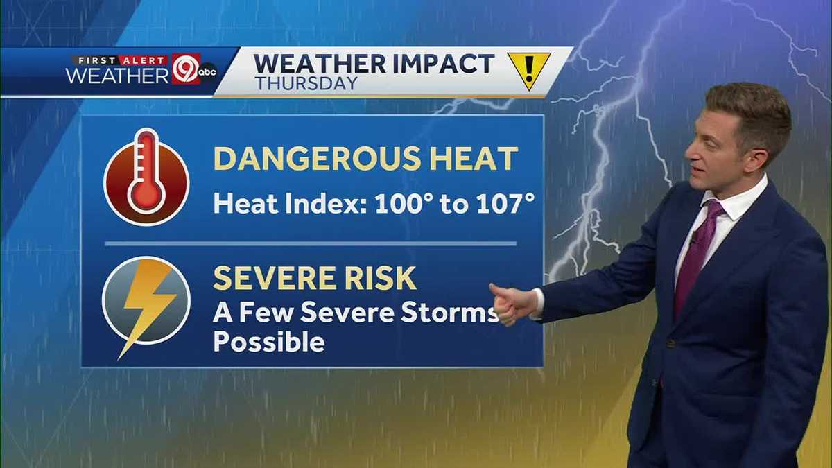
If thunderstorms develop, they could quickly become severe, with the potential to produce very large hail and damaging wind. The Kansas City skyline is expected to be warmer and more humid than yesterday, with temperatures expected to reach up to 105 degrees. The First Alert Weather Impact Day will be held on Thursday for excessive heat and evening thunderstorms. This could be the first official 90 degree day of the year, potentially marking the first time since 2005 that could see a significant 90 degree degree day. The weather team is warning for thunderstorms late Thursday afternoon and evening, which could quickly become severe. The most likely time for these thunderstorms to develop is after sunset. Heat and humidity are expected to continue to build ahead of a potential First Alert Day for excessive weather conditions. Make sure that children are drinking plenty of water and keeping pets well-hydrated and plenty of cool water.
Publicerad : 2 år sedan förbi Nick Bender, https://www.facebook.com/pages/Nick-Bender-KMBC/1454512491450896 i Weather
HOPEFULLY FOR FALL. BASEBALL CITY VIEW CAM THIS MORNING. IT’S WARMER. IT’S MORE HUMID THAN YESTERDAY. WE JUST CONTINUE THIS MARCH TOWARDS SUMMER HEAT FOR THIS AFTERNOON. COULD BE OUR FIRST OFFICIAL 90 DEGREE DAY IN THE BOOKS AT KCI 65 DEGREES RIGHT NOW WITH A MOSTLY CLEAR SKY, WE LOOK AHEAD TO YOUR 12 HOUR FORECAST FOR TODAY IN KANSAS CITY. WE’LL BE WINDIER AS WELL, SOUTH TO SOUTHWEST WIND 10 TO 15MPH THIS AFTERNOON, AND RIGHT AROUND 90 DEGREES. COULD BE THE FIRST 90 DEGREE DAY OF THE YEAR. IF WE DON’T REACH 90 TODAY, WE WILL GET THERE TOMORROW. AND THAT IS THAT IS A GUARANTEE. 89 IN LEE’S SUMMIT, 91 IN LIBERTY, 92 DEGREES IN SAINT JOSEPH. A LITTLE BIT OF A BREEZE TO HELP MOVE THINGS AROUND A BIT, BUT IT’S GOING TO FEEL HOT OUT THERE IN THE SUNSHINE. THURSDAY IS A FIRST ALERT WEATHER IMPACT DAY TOMORROW. TWO IMPACTS YOU NEED TO GET READY FOR. THE FIRST ONE IS EXCESSIVE HEAT IN THE AFTERNOON. HEAT INDEX VALUES BETWEEN 100 AND 107, AND THEN WE’LL TRACK A COLD FRONT THURSDAY EVENING. THIS IS LOOKING LIKE A BOOM OR BUST. A BOOM OR BUST SETUP. SO WE’RE EITHER GOING TO GET NO STORMS, WHICH IS A POSSIBILITY. OR THE STORMS THAT DO DEVELOP. THURSDAY EVENING WILL QUICKLY BECOME SEVERE AND THEY JUST HAVE A GIANT RESERVOIR OF INSTABILITY TO DRAW ON. IF STORMS DO DEVELOP, THEY COULD PRODUCE SOME VERY LARGE HAIL, DAMAGING WINDS ALSO A POSSIBILITY. IT’S A VERY LOW CHANCE OF TORNADOES. THIS IS FROM LATE THURSDAY AFTERNOON TO ABOUT 10:00 THURSDAY NIGHT. AGAIN, I WANT TO EMPHASIZE IF STORMS DEVELOP, IT COULD BE A STORM FREE NIGHT. BUT IF STORMS DEVELOP, YOU JUST LOOK ON THE NORTHERN HORIZON. YOU START SEEING STORMS GOING UP. YOU KNOW, MAKE SURE YOUR VEHICLES ARE IN THE GARAGE. IF YOU HAVE THAT OR COVERED PARKING BECAUSE THEY HAVE THE POTENTIAL TO PRODUCE SOME PRETTY BIG HAIL IF THEY DEVELOP. THURSDAY EVENING, A LITTLE COOLER ON FRIDAY, NOT BY MUCH. AND THEN WE’RE BACK INTO THE MID 90S. IT’S GOING TO BE HOT AND HUMID FOR FATHER’S DAY WEEKEND ON SATURDAY, SUNDAY A
WEATHER BLOG: Boom or bust storms to impact Thursday along with excessive heat Heat and humidity will continue to build today ahead of a First Alert Weather Impact Day on Thursday for excessive heat and evening thunderstorms.A few things you can do to get ready for Thursday afternoon heat index values above 100 degrees are to make sure you change your HVAC filter so it is fresh for the summer season. RELATED| Heat indexes will reach up to 105 degrees this week — Here are tips to save energy and keep coolIf you are able to, shift your outdoor workouts to early morning or early evening. Parents, make sure your children are drinking plenty of water if they are playing in the backyard or at the pool — easier said than done, I know!Finally, make sure your pets have plenty of cool water and a shady place to rest if they are outdoors. It's a "boom or bust" setup for thunderstorms late Thursday afternoon and evening. If thunderstorms develop, they could quickly become severe, with the potential to produce very large hail and damaging wind. The most likely time for thunderstorms to develop is after sunset, though there is at least some chance that a few will form late in the afternoon across far northwest and northern Missouri.If the First Alert Weather Team becomes more confident in thunderstorms developing Thursday evening, then Thursday will be upgraded to an Alert Day for a greater chance of severe thunderstorms. Heat and humidity will continue to build today ahead of a First Alert Weather Impact Day on Thursday for excessive heat and evening thunderstorms. A few things you can do to get ready for Thursday afternoon heat index values above 100 degrees are to make sure you change your HVAC filter so it is fresh for the summer season. RELATED| Heat indexes will reach up to 105 degrees this week — Here are tips to save energy and keep cool If you are able to, shift your outdoor workouts to early morning or early evening. Parents, make sure your children are drinking plenty of water if they are playing in the backyard or at the pool — easier said than done, I know! Finally, make sure your pets have plenty of cool water and a shady place to rest if they are outdoors. It's a "boom or bust" setup for thunderstorms late Thursday afternoon and evening. If thunderstorms develop, they could quickly become severe, with the potential to produce very large hail and damaging wind. The most likely time for thunderstorms to develop is after sunset, though there is at least some chance that a few will form late in the afternoon across far northwest and northern Missouri. If the First Alert Weather Team becomes more confident in thunderstorms developing Thursday evening, then Thursday will be upgraded to an Alert Day for a greater chance of severe thunderstorms.